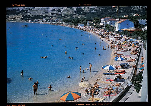
Croatian Islands
Škoji - The Croatian Islands
Pag Island
Pag island Info
The population on the island is 8398 inhabitants with total area on the island 284181553 square meters. The population density is 29.5 inhabitants per square kilometer. The hightest peak on the island is Sveti Vid, 348 m meters. The island is accessible by public transport (ferries).More information:
| GPS Latitude | 44.48583000 |
|---|---|
| GPS Longitude | 14.97139000 |
| Population | 8398 |
| Area(M2) | 284181553 |
| Coastline Lenght(M) | 302474 |
| Highest peak | Sveti Vid, 348 m |
| Population density | 29.5 |
Pag GPS coordinates
GPS location coordinates: 44°29'9.0"N 14°58'17.0"ESome Lighthouses in vicinity of Pag:
- Vir Lighthouse in Vir Island at a distance of 12.89 miles.
- Grujica Lighthouse in Islet Grujica near Losinj at a distance of 20.52 miles.
- Tri Sestrice (Rivanj) Lighthouse in Rivanj Island at a distance of 21.75 miles.
- Trstenik Lighthouse in Trstenik Islet near Cres at a distance of 23.10 miles.
- Veli Rat Lighthouse in Veli Rat at a distance of 24.23 miles.
- Ostri Rat Lighthouse in Zadar at a distance of 27.13 miles.
- Strazica Lighthouse in Prvic Island at a distance of 32.46 miles.
Marinas in vicinity of Pag:
- ACI Marina Simuni at a distance of 1.37 miles.
- ACI Marina Rab at a distance of 21.36 miles.
- Marina Veli Rat at a distance of 24.39 miles.
- ACI Marina Supetarska Draga at a distance of 25.06 miles.
- Y/C Marina Mali Losinj at a distance of 25.49 miles.
Neighbouring islands to Pag:
- Misnjak (Dugi Otok) Island at 3.83 miles away.
- Zakucenica Island at 3.86 miles away.
- Lukar Island at 3.89 miles away.
- Maun Island at 4.65 miles away.
- Skrda Island at 5.44 miles away.
- Mali Brusnjak Island at 5.99 miles away.
- Veli Brusnjak Island at 6.20 miles away.
- Pohlib Island at 6.89 miles away.
- Planik Island at 9.20 miles away.
- Hrid Planicic Island at 9.64 miles away.
Nearest Campsites to Pag:
- Strasko Campsite is at distance of 5.57 miles
- Maritime Campsite is at distance of 17.56 miles
- Zaton Campsite is at distance of 19.83 miles
- Peros Campsite is at distance of 20.26 miles
- Padova III Campsite is at distance of 20.81 miles
Pag Nearby Hotels:
- Apartmani Besedić in Mandre at a distance of 2.24 miles
- Apartments Paladina in Kolan at a distance of 2.36 miles
- Apartments Dvorski in Kolan at a distance of 2.39 miles
- Apartments Selez in Mandre at a distance of 2.46 miles
- Apartments Fumić in Mandre at a distance of 2.53 miles
- Apartments Tina Drazica in Novalja at a distance of 2.56 miles
