Croatian Islands
Škoji - The Croatian Islands
Molat Island
Molat island Info
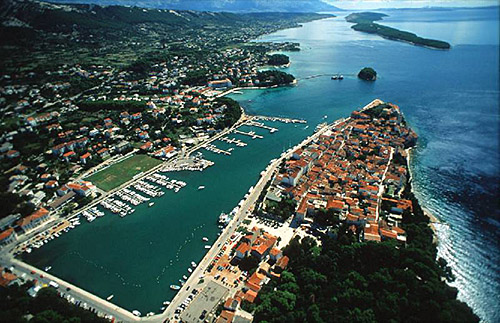
The population on the island is 207 inhabitants with total area on the island 22178022 square meters. The population density is 9.1 inhabitants per square kilometer. The hightest peak on the island is 148 meters. The island is accessible by public transport (ferries).More information:
| GPS Latitude | 44.23500000 |
|---|---|
| GPS Longitude | 14.83778000 |
| Population | 207 |
| Area(M2) | 22178022 |
| Coastline Lenght(M) | 51593 |
| Highest peak | 148 |
| Population density | 9.1 |
Molat GPS coordinates
GPS location coordinates: 44°14'6.0"N 14°50'16.0"ESome Lighthouses in vicinity of Molat:
- Veli Rat Lighthouse in Veli Rat at a distance of 5.79 miles.
- Tri Sestrice (Rivanj) Lighthouse in Rivanj Island at a distance of 9.65 miles.
- Vir Lighthouse in Vir Island at a distance of 10.44 miles.
- Grujica Lighthouse in Islet Grujica near Losinj at a distance of 17.93 miles.
- Ostri Rat Lighthouse in Zadar at a distance of 19.54 miles.
- Sestrica vela (Tajer) Lighthouse in Dugi Otok Island at a distance of 32.06 miles.
- Trstenik Lighthouse in Trstenik Islet near Cres at a distance of 32.57 miles.
Marinas in vicinity of Molat:
- Marina Veli Rat at a distance of 6.32 miles.
- ACI Marina Simuni at a distance of 17.21 miles.
- Marina Veli Iz at a distance of 18.55 miles.
- Marina Olive Island (Ugljan) at a distance of 19.01 miles.
- Marina Borik (D-Marin Borik) at a distance of 19.78 miles.
Neighbouring islands to Molat:
- Tovarnjak (Molat) Island at 2.15 miles away.
- Riznjak Island at 2.20 miles away.
- Tramercica Island at 2.31 miles away.
- Obljak (Molat) Island at 2.70 miles away.
- Knezacic Island at 2.89 miles away.
- Tramerka Island at 3.21 miles away.
- Golac near Molat Island at 3.28 miles away.
- Brscak Island at 3.64 miles away.
- Tun Mali Island at 4.06 miles away.
- Trata Island at 4.10 miles away.
Nearest Campsites to Molat:
- Maritime Campsite is at distance of 14.33 miles
- Zaton Campsite is at distance of 16.29 miles
- Peros Campsite is at distance of 16.57 miles
- Borik Campsite is at distance of 19.95 miles
- Strasko Campsite is at distance of 21.01 miles
Molat Nearby Hotels:
- Vila Orada in Molat at a distance of 0.90 miles
- Casa Riva in Molat at a distance of 2.54 miles
- Hotel Lavanda in Bozava, Dugi otok at a distance of 7.40 miles
- Hotel Agava in Bozava, Dugi otok at a distance of 7.41 miles
- Hotel Mirta in Bozava, Dugi otok at a distance of 7.41 miles
- Hotel Maxim in Bozava, Island Dugi otok at a distance of 7.42 miles
