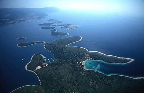
Croatian Islands
Škoji - The Croatian Islands
Glavat (Mljet) Island
Glavat (Mljet) Island Info
Glavat (Mljet) is an unpopulated island with total area of 80574 square meters (m2). The lenght of its coastline is 1491 meters. There is no public transport to Glavat (Mljet).| GPS Latitude | 42.80553800 |
|---|---|
| GPS Longitude | 17.35869000 |
| Area(M2) | 80574 |
| Coastline Lenght(M) | 1491 |
Glavat (Mljet) GPS coordinates
GPS location coordinates: 42°48'19.9"N 17°21'31.3"ESome Lighthouses in vicinity of Glavat (Mljet):
- Glavat Lighthouse in Islet Glavat near Lastovo at a distance of 11.13 miles.
- Sestrica vela (Korcula) Lighthouse in Islet Vela Sestrica near Korcula at a distance of 13.26 miles.
- Sucuraj Lighthouse in Sućuraj, Hvar Island at a distance of 23.53 miles.
- Struga Lighthouse in Skrivena Luka, Lastovo Island at a distance of 24.68 miles.
- Plocica Lighthouse in Islet Plocica near Korcula at a distance of 31.51 miles.
- Sveti Andrija Lighthouse in Sveti Andrija Island at a distance of 32.00 miles.
- Grebeni Lighthouse in Islet Grebeni near Dubrovnik at a distance of 36.54 miles.
Marinas in vicinity of Glavat (Mljet):
- ACI Marina Korcula at a distance of 15.43 miles.
- Marina Solitudo (Lastovo) at a distance of 27.35 miles.
- ACI Marina Dubrovnik at a distance of 39.94 miles.
- Marina Ramova ( Baska Voda) at a distance of 40.52 miles.
- ACI Marina Vrboska (Hvar) at a distance of 43.09 miles.
Neighbouring islands to Glavat (Mljet):
- Pomestak Island at 1.01 miles away.
- Moracnik Island at 2.22 miles away.
- Tajnik Island at 2.29 miles away.
- Vrata Island at 2.77 miles away.
- Kobrava Island at 3.19 miles away.
- Lirica Island at 5.85 miles away.
- Kosmac Island at 7.06 miles away.
- Miriste Island at 7.17 miles away.
- Dingacki Skoj Island Island at 7.35 miles away.
- Mljet Island at 10.09 miles away.
Nearest Campsites to Glavat (Mljet):
- Zakono Campsite is at distance of 11.11 miles
- Vrela Campsite is at distance of 11.12 miles
- Vela Postrana Campsite is at distance of 12.38 miles
- Vala Campsite is at distance of 13.58 miles
- Paradiso Campsite is at distance of 13.63 miles
Glavat (Mljet) Nearby Hotels:
- Hotel Odisej in Govedjari, Mljet Island at a distance of 0.86 miles
- X-Rooms Mljet in Polace at a distance of 1.69 miles
- Villa Lucija in Mljet at a distance of 1.70 miles
- Apartments Radulj in Mljet at a distance of 1.79 miles
- Villa Radulj in Mljet at a distance of 5.70 miles
- Apartments Blazevo in Putnikovici at a distance of 9.77 miles
